
Wasgamuwa & Angamedilla Nat’l Parks
These two parks are contiguous, Angamedilla NP representing the northern extension of the Wasgamuwa NP. Angademilla NP borders on the Parakrama Sumudra lake and lies directly opposite our field research station, the Smithsonian Primate Research Station (monkey camp).
Wasgamuwa National Park
- Area: about 393 km2
- Status: The park initially had been declared a game sanctuary under British rule in 1907. It was declared a Strict Nature reserve in 1938, and was upgraded to National Park status on 07 August 1984.
- Main Entrance: off the Giritale to Laggalle-Pallegama Road, enter from Hettipola town at its southern boundary.
- Travel time from PRS (monkey camp): about 200 min to the main entrance. But it’s northern gate is accessible in about 30 min from PRS.
Geography and habitat: The park is bound in the west by the Sudukanda mountain range and the Amban Ganga river, and on the east by the Mahaweli river. There are no large reservoirs in this park. Dry evergreen forest predominate the northern aspects and more diverse moister dry evergreen forest are in the south. The riverine forests along the banks of the Mahaweli and Amban rivers are dominated by kumbuk (Terminalia arjuna), mee (Madhuca longifolia), owila (Polyalthia longifolia), thimbiri (Diospyros malabarica). The inner the park is mostly closed forest with occasional open meadows or grassland. The forest is dominated by weera (Drypetes sepiara), palu (Manilkara hexandra), kon (Schleichera oleosa), satin (Chloroxylon swietenia), milla (Vitex pinnata) and ebony (Diospyros ebeneum.).
 History and culture: Initiated in ancient times (1st Century BC), the irrigation network that feeds the reservoirs to the north, were fed by waters diverted from the Amban Ganga. These, more than two thousand years old systems, are still in use today. The site of Buduruwayaya in the SW corner of the park, is a large archaeological complex of temples and Buddha statues. One of the key battles, in the 2nd Century BC, between the kings Dutugemunu and Elara occurred at Yudaganawa in the SE corner of the park. In recent history, the park began as a hunting reserve in 1907 and therefore has a long period of protection.
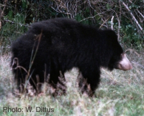 Wildlife: Being a relatively moist and closed forest habitat, the park supports a fairly high density of animals native to the dry zone. Elephants (estimated at about 150 individuals), that prefer grassland habitats are present in the park, but are not as numerous as in other parks where more extensive grasslands prevail. Among the large mammals, bears are fairly common. All animals common to the dry zone are found here.
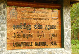
Angamedilla National Park
- Area: about 75 km2,
- Status: established 06 June 2006.
- Main entrance: from Angamedilla village and anicut.
- Travel time by road from PRS (monkey camp): 30 min. The park lies opposite the Smithsonian Research Station, and also can be accessed from there by boat.
Geography and habitat: This park is the northern contiguous extension of the Wasgamuwa NP. The Sudukanda mountain range cuts through the park from south to north. The western boundary is marked by the Elahera Yoda-ela stream and by the Parakrama Samudra lake in the east. It is a dry evergreen forests that serves as a catchment for the Parkrama Samudra lake. Most of the forest is secondary scrub with weera trees (Drypetes sepiara) the most common. Some riverine forests occurs along the anicut and irrigation channel to the Parakrama Samudra lake. A stream, the Radavige Oya, supports a narrow belt of riverine forest.
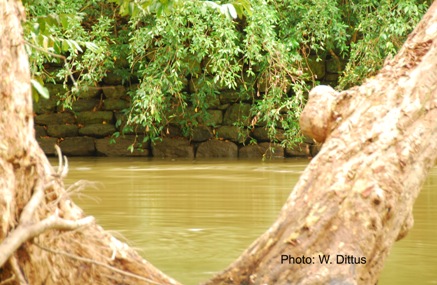 History and culture: The Angamedilla anicut was built by king Parkrama Bahu in the 11th Century AD, and diverts water from the Amban Ganga river for more than 15 km along man-made channels, northward to feed the Parakarama Samudra reservoir. The ancient stonework of the anicut is located near the entrance gate to the park. Minor archaeological remains can be found scattered throughout the park.
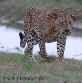 Wildlife: Elephants come to the grasslands and water on the receding water of the Parakrama Samudra lake during the dry season (June to October) and can be observed from our monkey camp. Animals typical of the dry zone forests, including leopards, are found here, especially in the moister sections of the park. There are old roosting areas (clusters of trees) for aquatic birds on the park side (western) shores of the Parakrama Samudra lake. The elephants, other wildlife and water birds can be observed by boat safaris starting at our monkey camp.